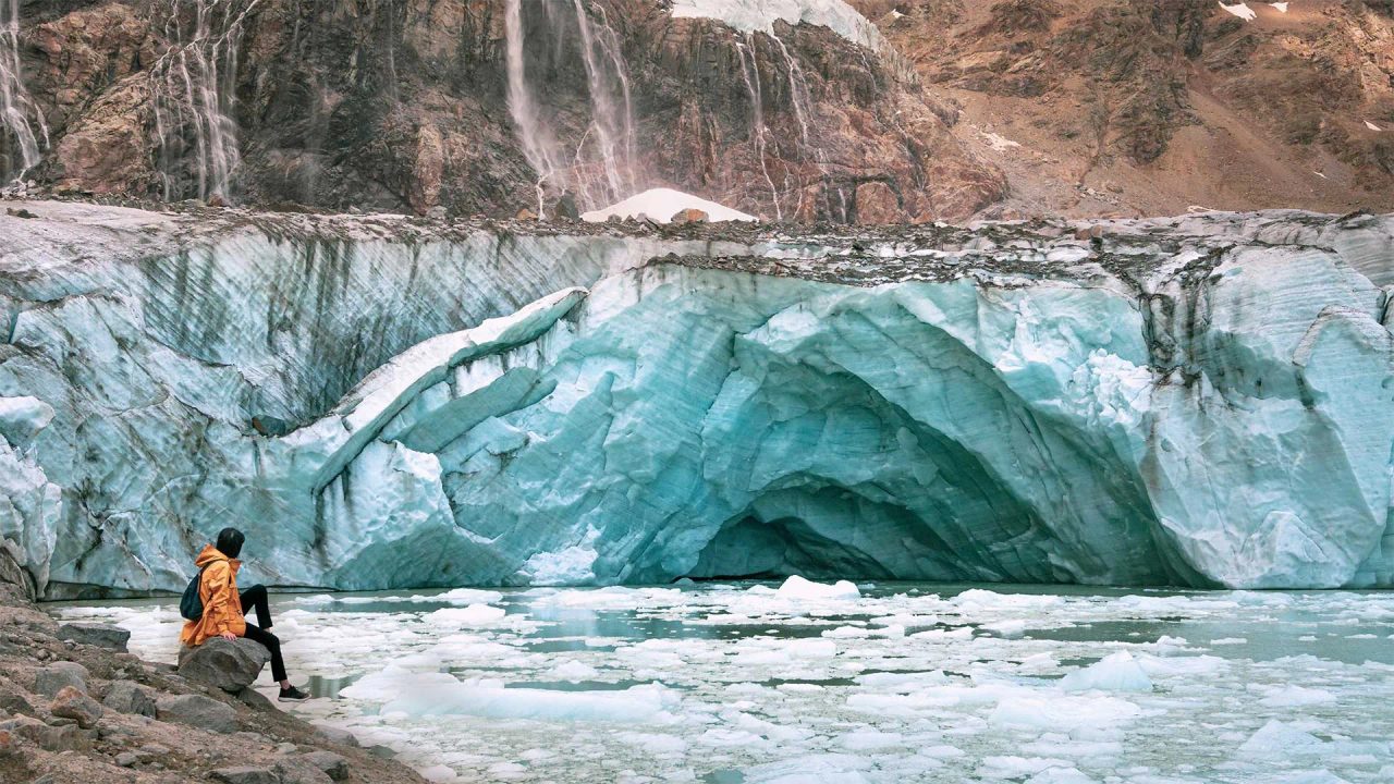
You've dreamed your whole life of venturing inside a glacier, but are you still waiting to set off on that long-awaited trip to Iceland? Well, you don't need to go so far north to explore a glacier; just stop a little earlier. The Fellaria Glacier Hike is perfect for you, just a stone's throw from home!
Where Is the Fellaria Glacier?
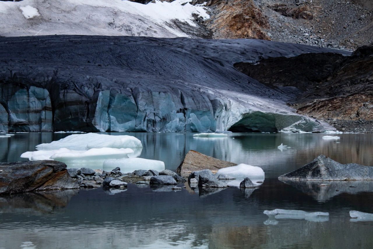
The Fellaria Glacier is one of the most beautiful and wild places in our country. A corner of the world where time seems to have stopped and where human hands have fortunately not intervened.
This incredible and still little-known place is hidden among the Lombardy Alps in the heart of Valmalenco. To find it, you have to venture into the territory of Lanzada, a small village in the province of Sondrio located very close to the Swiss border.
The starting point of the hike we'll discuss shortly is the Alpe di Gera Dam. You can comfortably leave your car in the dam's parking lot, which is spacious enough to accommodate many enthusiastic trekkers' vehicles.
The place is easily reachable from all Lombardy provinces by following signs for Sondrio. Once near the city, take the detour to the provincial road 15 towards Campo Moro – Lanzada and then on to the dam.
If you want, you can also leave your car at the Campo Moro parking lot, but this will add 3 km to the hike! If the dam parking lot is full, you can park at the nearby Zoia or Poschiavino refuges.
[activecampaign form=22 css=1]
The Fellaria Glacier Hike
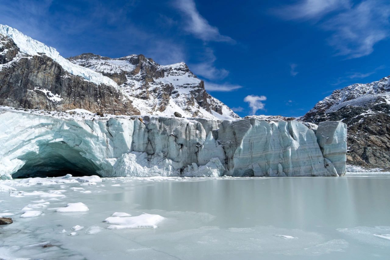
The Fellaria Glacier hike takes you to 3,500 meters above sea level, surrounded by mountains and crystal-clear streams, to touch the sky with a finger. The trek has a moderate difficulty level, so it’s not too demanding and is suitable for everyone, including children.
However, a good physical condition is still recommended before undertaking it, and it is not advised for those unaccustomed to long mountain walks. mountain. In fact, the one-way route takes 3-4 hours always uphill, and the trail is mostly dirt and sometimes challenging. Equally important is to equip yourself properly and dress suitably for the mountain. Sneakers, no matter how comfortable, are prohibited, and
hiking boots are mandatory . It’s best to wear technical trekking clothes and bring a windproof and waterproof jacket.The best period to undertake this adventure is
from June to September , when weather and trail conditions are better and more stable.In spring, autumn, and winter, sudden changes in temperature or weather conditions may occur, risking your safety. In any case, it is always best to
In spring, autumn, and winter, sudden changes in temperature or weather conditions may occur, putting your safety at risk. In any case, it is always better before setting off. The Route
The first part of the hike lasts about an hour and a half and leads
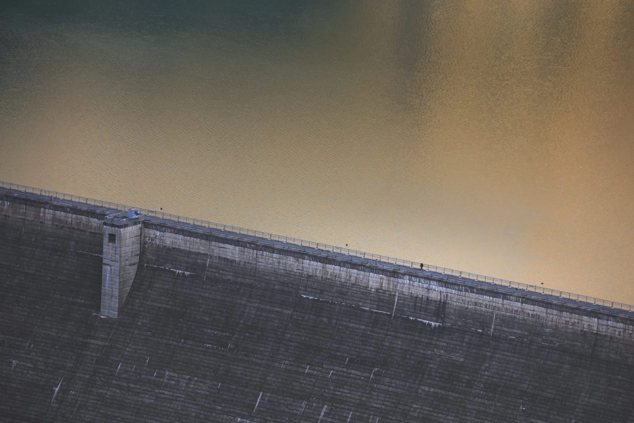
from the dam parking lot to the Bignami Refuge , where the real hike begins.Once you leave your car, head towards the dam and climb the
concrete ramp that ascends the outer wall of the structure. Once at the top, turn left and continue admiring this majestic construction from above. After finishing the path atop the dam, continue along the that climbs the outer wall of the structure. Once at the top, turn left and continue admiring this majestic construction from above. After finishing the path on top of the dam, proceed along the This trail is a loop path that goes around the entire lake. If you want, you can walk it completely and then, back at the starting point, follow signs to the Bignami Refuge. Or wait until the return trip to choose the route that will let you explore the other side as well..
The trail in question is a loop path that circles the entire lake. If you wish, you can also walk it entirely and then, once back at the starting point, follow the signs to the Bignami refuge. Alternatively, wait on the return to choose the route that will allow you to explore the other side as well.
Upon reaching the first stop, you can continue without stopping or pause to regain energy and discover the
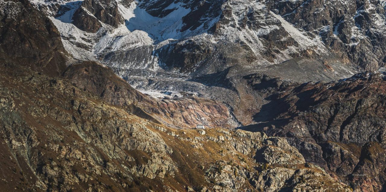
local culinary offerings at the refuge. The view from this plateau at 2,401 meters above sea level is incredible, and in the distance, you can already spot the
waterfall of the Eastern Fellaria Glacier From the refuge, trails branch off that will lead you to the foot of the glacier. The.
Luigi Marson glaciological trails are three: Trail A
- : the shortest, which in just over an hour and a half takes you to the western Fellaria lake, but skips the most beautiful part of the hike, the eastern Fellaria lake.Trail B
- : the longest and most difficult, following a very steep path before joining and continuing along Trail C. Recommended only for the most experienced trekkers.Trail C
- : the direct route to theFellaria Glacier and the eastern glacier, not overly strenuous and reaching this wonderful destination in less than two hours. It is therefore recommended to take Trail C, paying close attention to the informational panels, signs, and blue dots that guide you along the correct path.
The Final Stage
Trail C climbs ever higher, on a
very steep, rugged, and challenging path . Be careful as you proceed; the first section narrows and is somewhat exposed. Although safe, always keep your eyes open and watch your step (which is why hiking boots are essential!). Pay attention as you proceed, because in the first stretch the road narrows and is somewhat exposed. Although safe, always keep your eyes wide open and watch where you step (which is why hiking boots are essential!)
pastures of Alpe Fellaria : scattered ruins, traditional buildings, and green meadows crowded with goats and cows. The landscape is among the most charming imaginable, dotted with all kinds of watercourses: streams, waterfalls, and small lakes. Numerous wooden and metal bridges built along the way will help you cross them.: some ruins here and there, traditional buildings, and green pastures overrun by goats and cows. The landscape is among the most charming imaginable and is dotted with all kinds of watercourses: streams, waterfalls, or small lakes. To cross them, numerous wooden and metal bridges have been built along the way.

steep ascent covered with boulders . It takes about 40 minutes to overcome, but once at the top, you will have reached your destination!The place is
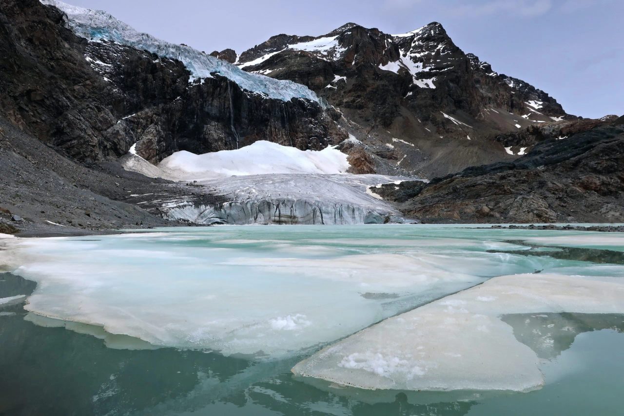
magical and wild at the same time . The glacier stretches out before you, and the lake at its foot is a muted turquoise but unique. Pieces of ice broken off from the glacier float on the water, and the air is filled with the constant sound of the waterfall and the glacier's creaking.. The glacier stretches out before you, and the lake at its foot is a muted but unique turquoise. Pieces of ice detached from the glacier float on the water, and the air is filled with the constant sound of the waterfall and the creaking of the glacier itself.
rock and ice falls are frequent occurrences , which is why it is strictly forbidden to approach or climb on the glacier! However, even this pristine corner of our world is heavily affected by climate change. In the 1800s, its extent was nearly 23 km, which is why it is strictly forbidden to approach or climb the glacier! However, even this corner of our homeland, as pristine as it is, is severely challenged by climate change. In the 1800s, its extent was nearly 23 km2, today it is planned right here!